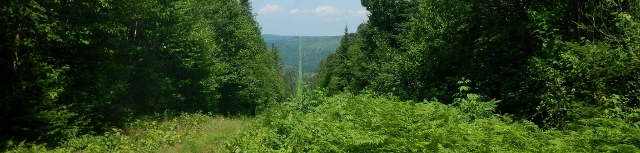
Section 3 - North Line
The initial land boundary runs north from the source of the St. Croix River until it intersects with the St. John River. This 125-kilometre (78-mile) section of land boundary passes through many kilometers of both fertile farmland and coniferous forests. This section marks the beginning of the cleared 6 meter (20-foot) vista, used to enhance the visibility of the border through dense brush and forested areas whenever encountered along the border.
Section 4 - St. John River
The boundary follows the St. John River from the North Line for a distance of 115 kilometres (72 miles) to the mouth of the St. Francis River. This region is highly developed both agriculturally and commercially, with towns and majors highways along both sides of the river. Active development along the river affects monument durability, which requires more frequent maintenance.
B-46; B-47; B-48; B-49; B-50; B-51; B-52; B-53; B-54; B-55; B-56; B-57
Section 5 - St. Francis River
From the St. John River, the boundary ascends the St. Francis River a distance of 70 kilometres (43 miles) to the source of the river at Lake Pohénégamook. The river, through much of its length, passes through dense woods on the United States side, low farm lands on the Canadian side and has a tendency to meander and change course. What was once entirely a water boundary now has long stretches where the river has diverted, leaving the boundary on land.
B-41; B-42; B-43; B-44; B-45; B-46
Section 6 - Southwest and South Lines
The line makes landfall at the source of the St. Francis River near Estcourt, Québec, and follows a straight-line course in a southwesterly direction for a distance of 103 kilometres (64 miles) to Lac Frontière, Québec. The region is heavily forested with very little development along the boundary. At Lac Frontière, the line swings in a southerly direction for a distance of 32 kilometres (20 miles) until it intersects the Southwest Branch of the St. John River.
B-34; B-35; B-36; B-37; B-38; B-39; B-40
Section 7 - Southwest Branch of the St. John River
The line again becomes a water boundary as it follows the Southwest Branch of the St. John River from the intersection of the South Line to the source of the river at Little Lake St. John. This 61-kilometre (38-mile) section of the boundary ascends the small shallow stream through remote and densely wooded terrain. The boundary is defined by 1,045 turning points which are referenced by 99 reference monuments.
B-24; B-25; B-26; B-27; B-28; B-29; B-30; B-31; B-32; B-33
Section 8 - Highlands N.E. Section
One of the most difficult and demanding sections of the boundary to maintain is the 282-kilometre (175-mile) height-of- land boundary from Little Lake St. John to Halls Stream. The boundary follows the crests of mountains and ridges that divide the water flowing into the St. Lawrence from the water flowing eastward into the Atlantic. The mountains in the Highlands range upwards to 1,200 metres (3,900 feet) in elevation and are heavily forested.
Section 9 - Highlands S.W. Section
The southwestern section is the most difficult portion of the Highlands boundary to maintain. Parts of this portion of the line are inaccessible by any type of land vehicle.
B-14; B-15; B-16; B-17; B-18; B-19
Section 10 - Halls Stream
From the Highlands, the boundary follows Halls Stream from its source until it intersects the 45th Parallel boundary. Again, this water boundary follows a shallow stream through heavy forest along much of its length. As it approaches the 45th Parallel, however, the stream passes through low farmland where it has a tendency to change course during flood conditions. Consequently, in many areas where the boundary once followed the river, it now crosses land.
B-8; B-9; B-10; B-11; B-12; B-13
Section 11 - West Line (QC/VT)
The 45th Parallel, or West Line boundary, from Halls Stream to the St. Lawrence River, divides fertile farmlands along southern Quebec and northern Vermont and New York over a distance of 250 kilometers (155 miles). Many parts of this region were settled before any attempt had been made to define the boundary. Consequently, the line passes over fields, across a cemetery, and through villages where it intersects many buildings. The original marked line dates back before the War of lndependence, and was no more than a compass-line run to establish the boundary between two British colonies. In retracing the original line, many deflections were encountered and the line was found to deviate a considerable distance from the 45th Parallel.
Section 12 - West Line (QC/NY)
The Quebec-New York boundary passes through farmland and forests. Numerous line houses were constructed during prohibition in the United States. While most of these have since disappeared, several still serve as taverns, hotels and country stores along the West Line boundary.This section of the line is easily accessible with many roads and trails crossing the boundary.