PREVIOUS COMMISSIONERS
For the United States
1904-1915 Otto H. Tittman
1915-1921 Edward C. Barnard
1921-1929 E. Lester Jones
1929-1935 James H. Van Wagenen
1935-1945 Thomas Riggs
1945-1953 John A. Ulinski
1953-1961 Samuel L. Golan
1961-1969 Edward King
1969-1977 Richard L. Herman
1977-1981 William M. Schreiber
1981-1985 Frank R. Whetstone
1985-1991 David C. Fischer
1991-1993 Allen C. Kolstad
1993-1996 Clyde Moore (Acting)
1996-2002 Thomas L. Baldini
2002-2007 Dennis L. Schornack
2007-2008 David L. Berhhardt
2008-2014 Kyle K. Hipsley (Acting)
2014-2025 Kyle
K. Hipsley
2025- J.T. Moore (Acting)
For Canada
1904-1916 William F. King
1916-1924 James J. McArthur
1924-1931 John D. Craig
1931-1947 Noel J. Ogilvie
1947-1950 James M. Wardle
1950-1951 J. Leslie Rannie
1951-1957 J. Earl R. Ross
1957-1976 A. Frederick Lambert
1976-1991 Alec C. McEwen
1991-1996 Suzanne Jacques
1996-2005 Michael O'Sullivan
2005-2017 Peter J. Sullivan
2017-2025 Jean Gagnon
2025- Martin Gingras
On June 4, 1908, the United States and the United Kingdom (on behalf of Canada) signed a treaty to create the International Boundary Commission. Both countries assigned their own expert geographer or surveyor to serve as Commissioner. Their roles were to accurately define and mark the boundary separating the two countries.
In 1925, a second treaty between the United States and Canada was entered into making the International Boundary Commission a permanent organization and empowered the two Commissioners to maintain an effective boundary line, and to determine the location of any point on the boundary line as needed. The Canadian Commissioner is guided by the International Boundary Commission Act (1960), legislation that coincides with the treaty's purpose of maintaining an effective boundary line between Canada and the United States.
The Commission comprises both an American and a Canadian Commissioner, and each is responsible for his own budget, equipment, and staff. The United States Commissioner is appointed by the President and reports directly to the Secretary of State. For Canada, the International Boundary Commission Act provides that the Surveyor General is Canada's Commissioner. The Canadian Commissioner reports to the Minister of Foreign Affairs on policy matters and is located within the Department of Natural Resources for administrative and operational purposes.
|
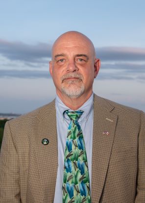
J.T. Moore Acting Commissioner for the United States
With the passing of Commissioner Kyle K. Hipsley in March 2025, J.T. Moore became the Acting U.S. Commissioner for the International Boundary Commission, United States and Canada. Mr. Moore has been serving as Deputy Commissioner since 2015. He joined the Commission in 2006 as Lead Survey Engineer overseeing its three U.S. field offices and boundary maintenance projects. With over 36 years of surveying, he started his career in the private sector in 1989 in Virginia Beach, VA. He began his service with the Federal government in 1992 with the National Geodetic Survey spending seven years conducting high accuracy GPS surveys on airfields in support of FAA programs. From there, he moved on to the Department of Defense for another seven years working for HQ Air Force Flight Standards Agency as a geodesist supporting air traffic control and landing system evaluations. |
|
Martin Gingras, QLS, C.L.S. Commissioner for Canada
Martin Gingras, QLS, C.L.S., took office as Canada’s Commissioner to the International Boundary Commission on April 24, 2025, by virtue of being appointed Canada’s Surveyor General. As Surveyor General, he is also responsible for the Canadian Geodetic Survey. Prior to his appointment, Mr. Gingras was a Senior Director with the Department of Natural Resources and the Deputy Surveyor General – Eastern Canada Region. His responsibilities included overseeing the operations of the Canadian Section of the International Boundary Commission. Mr. Gingras holds a geomatics degree from Laval University and holds commissions to practice land surveying in Quebec and on Federal Lands throughout Canada. |